
The river rises
Every June, the Yangtze rises. You can see it happen if you pay attention.
I walk to the river most mornings. I’ve written about this before, about how the river is the city’s heartbeat when the water is low. But in summer, the river changes. The water level creeps up the levee wall, centimeter by centimeter. The sandbanks that fishermen stand on in March disappear. The stone steps leading down to the water get swallowed one by one. By July, the river is brown, fast, and wider than it looks like it should be.
There are markers on the levee wall near Hankou. White numbers painted on concrete. Water levels. The old people who walk the riverfront every morning stop and look at them. Nobody says anything. They just look, nod, and keep walking.
I asked my father-in-law once what exactly they were looking at. He said: “We’re checking if the river remembers us.”
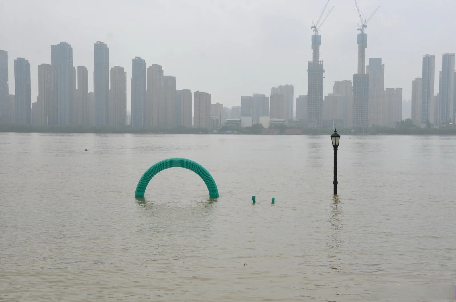
July on the Yangtze. The water is three meters higher than it was in March. Those steps you see? They’re underwater.
The 1931 flood: when the city drowned
The worst flood in Wuhan’s modern history happened in 1931. I say “modern” because the Yangtze has been flooding for millennia. But 1931 was different.
The rain started in June and didn’t stop. The Yangtze, the Han River, and every tributary in central China swelled simultaneously. By the end of July, the levees around Wuhan started failing. One by one. The three towns, Hankou, Hanyang, and Wuchang, sat at the confluence of two rivers. There was nowhere for the water to go but into the city.
Hankou got it worst. The water didn’t come as a wall. It came as a slow, steady rise. People moved upstairs. Then to the roof. Then they watched the roof go under. The water reached the second floor of the European-style buildings on the Bund, buildings that were considered the tallest and strongest in the city. The foreign concessions, built on the highest ground available, still flooded to waist depth on the ground floor.
Estimates vary, but between 140,000 and 400,000 people died in the 1931 Wuhan flood. The range tells you something: nobody was counting. Bodies floated in the streets for weeks. Refugees crowded onto the high ground near the Yellow Crane Tower in Wuchang, which sits on a hill. Disease spread. The Nationalist government was overwhelmed.
If you look at old photographs of Wuhan from 1931, you see a city that looks like Venice. Except the water is brown, people are on rooftops, and the expression on every face is the same: not panic, just exhaustion. The kind of exhaustion that comes when you realize the water isn’t leaving.
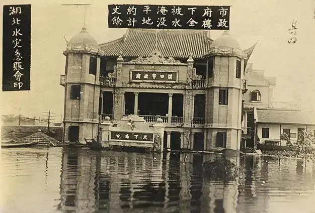
The 1931 flood marker near the Hankou riverfront. The line shows where the water reached that summer.
1954: the flood that tested a new nation
In 1954, the Yangtze rose again. This time, the water level was actually higher than 1931 in some measurement points. But the outcome was different.
The People’s Republic of China was five years old. The government mobilized everything. Soldiers, workers, students, farmers. Hundreds of thousands of people were sent to the levees. My wife’s grandmother was 16. She carried sandbags. She told us about it before she passed: the mud, the rain, the fear, the singing. They sang while they stacked sandbags because it was the only way to keep going.
They held the levees. Wuhan didn’t drown, but it was close. The water came within centimeters of the top of the main Hankou levee in August. But the levees held.
The 1954 flood became a founding story for modern Wuhan. It proved that the new government could protect the city, and that the river was still the boss. The levees held, but just barely. After 1954, the government invested heavily in flood control infrastructure. The levees were raised, the flood retention basins upstream were built, and monitoring stations multiplied along the river.
In 1969, the city built the Flood Control Monument (防汛纪念碑) on the Hankou riverfront. It’s a tall, narrow obelisk at the top of what’s now the riverfront park. The inscription on the front of the obelisk commemorates the 1954 flood and the people who held the line. The base has a relief sculpture of workers carrying sandbags.
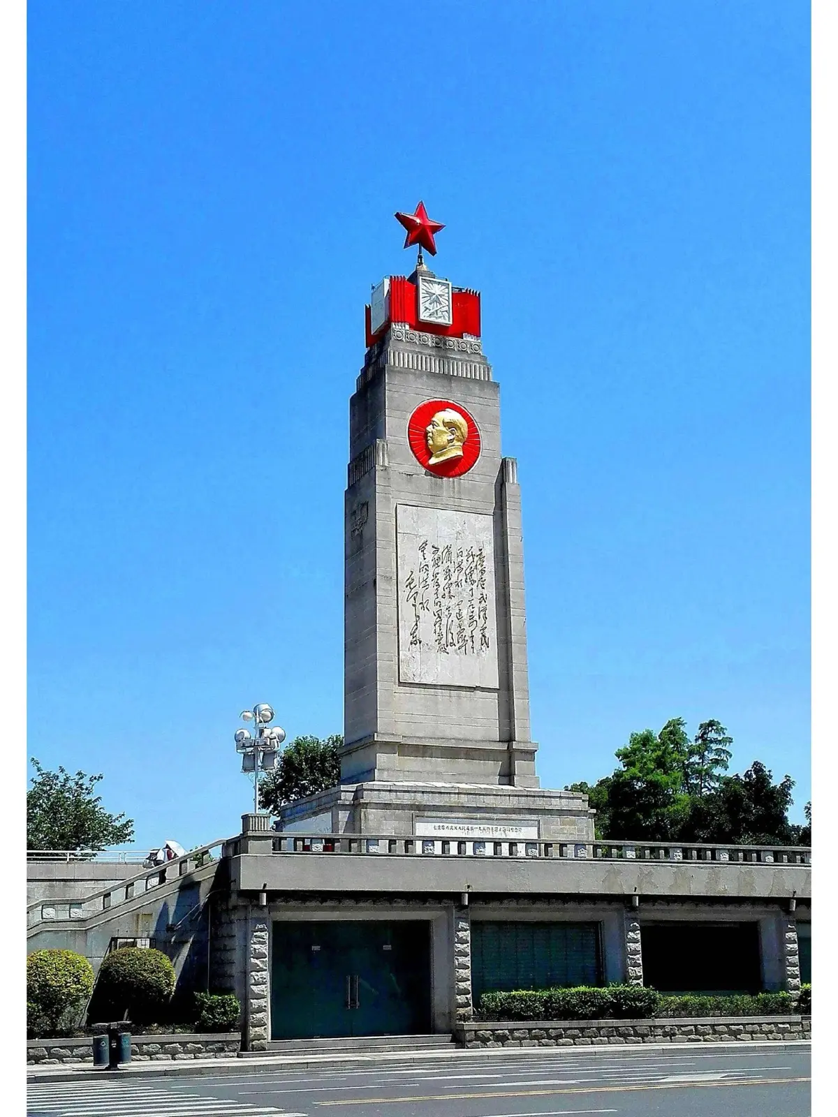
The Flood Control Monument stands on the Hankou riverfront. Built 1969, commemorating the 1954 flood.
1998: the flood that mobilized a nation
The summer of 1998 was the last time Wuhan genuinely feared for its life.
The Yangtze had been rising since June. By July, the water level at Wuhan exceeded the warning line. By August, it exceeded the 1954 level. Every day, the news reported the water level like it was a war update. And in a sense, it was.
The government ordered full mobilization. PLA soldiers, civilian volunteers, and cadres were all on the levees. They worked in shifts, 24 hours a day, and the soldiers slept on the levees. My mother-in-law remembers the sound of trucks at 3:00 AM, carrying sand and gravel to reinforce weak points. She remembers the radio announcements: “Water level at Hankou: 29.43 meters.” Then the next day: “29.52 meters.” Then: “29.73 meters.” Each one of those numbers was a countdown.
The levees held. Barely. The water peaked at 29.43 meters on August 19, 1998. The highest level ever recorded at Wuhan, higher than 1954. But the reinforced levees and the flood diversion zones upstream kept the city dry.
After 1998, China went all-in on flood control. The Three Gorges Dam, which was already under construction, became a national priority. It was completed in 2006 and fully operational by 2012. The dam sits upstream of Wuhan and can hold back floodwater. It doesn’t eliminate flood risk. The Yangtze has too many tributaries below the dam for that. But it takes the edge off the worst-case scenarios.
My father-in-law, who was 42 during the 1998 flood, volunteered on the levees for two weeks. He said the atmosphere was like nothing else he’d experienced: “Everyone was there. Rich people, poor people, government officials, factory workers. Nobody cared about status. We were all just stacking sandbags and watching the water. When it finally started dropping, I cried. Everyone did. You don’t forget that.”
2016: the flood I lived through
I experienced one flood season that scared me. July 2016.
It wasn’t the Yangtze that did it. The main river held. It was the urban drainage. Wuhan got hit by a series of storms that dumped a month’s rain in 24 hours. The city’s pump systems couldn’t keep up. The 166 lakes, normally the city’s beauty, became storage tanks with nowhere to drain. The water had to go somewhere, and that somewhere was the streets.
My neighborhood in Hongshan got lucky. We were on slightly higher ground. But nearby, entire intersections were under a meter of water. Cars floated. The subway tunnels flooded. People were stuck in their apartments for two days. The photos looked like the 1931 pictures, except in color.
The city responded. After 2016, Wuhan invested billions in drainage upgrades. They built massive pump stations, dredged the lakes, and widened the channels connecting the lakes to the rivers. The 2020 flood season was bad nationally, but Wuhan, by then also dealing with COVID, managed the water without major urban flooding.
I’m not going to tell you the drainage is perfect now. It isn’t. When the storms come hard and fast, there are still streets that go under. But the city learns. Every flood, it learns. That’s the story of Wuhan and water: 1,800 years of the same lesson, repeated.
What you can see today
If you visit Wuhan and want to understand the flood story, here’s what to look for:
The riverfront parks. The Hankou Bund and the Wuchang riverfront are built on top of the levees. The wide walkways, the gardens, the plaza where people fly kites. All of it sits on flood-control infrastructure. The levee is under your feet. The park is the friendly face of a defensive wall.
The water level markers. On the levee wall near Wuhan Port in Hankou, you can see the painted numbers showing water levels. During flood season (June to August), the river is close to the top. In winter, it’s five meters below. The difference is the story of the city.
The Flood Control Monument. At the top of the Hankou riverfront park, near the entrance. It’s a 30-second walk from the riverside promenade. The monument isn’t large, but the relief sculptures at the base tell you everything: people carrying sandbags, people standing in water, people holding the line.
The river itself. Go to the Hankou riverfront in July. Stand at the railing. Look at the water. It will be brown, fast, and high. Then go back in January. The water will be green, slow, and low. The same river, unrecognizable. That difference, between summer and winter, between flood and drought, is what defines this city.
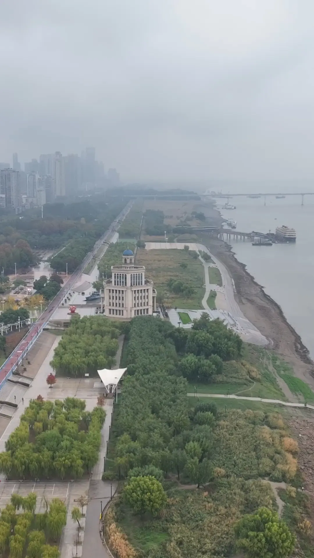
The Hankou riverfront park. Underneath these gardens and walkways is the levee that holds the Yangtze back every summer.
The river remembers
My father-in-law has a theory. He says the Yangtze tests Wuhan every generation. 1931. 1954. 1998. The city survives, and it gets better at surviving. But the river never stops testing.
He says: “The river is patient. It waits. One year, the rain will come wrong, the dam won’t be enough, and the water will come for us again. Not this year. Maybe not for another fifty years. But it will come.”
I used to think he was being dramatic. Then I lived through 2016, and I understood. The river gives Wuhan everything: the trade that made the city rich, the water that feeds the lakes, the culture that makes the city what it is. But the river also takes. Floods are not accidents in Wuhan. They are the river’s way of reminding the city who’s in charge.
The old people who check the water level markers every June understand this. They don’t panic or flee. They just check the numbers, nod, and keep walking. They’ve seen the river at its worst, and they know it will come again. They also know they’ll be here when it does.
Floods are one chapter of Wuhan’s relationship with the Yangtze. Read more: the river culture that defines the city, how the rivers created three towns, and the 166 lakes that buffer the floods.
Related:
-
The River Is the City: Wuhan’s Yangtze Culture: the river that gives and takes
-
Two Rivers, Three Towns: Understanding Wuhan’s Geography: why the city sits at the confluence
-
Wuhan’s 166 Lakes: The City on Water: the lakes that store floodwater
-
Hankou History: China’s Greatest River Port: the trade that the river made possible
-
Walking the Yangtze Bridge at Night: the bridge that connected the towns the river divided
-
76 Days: What the Wuhan Lockdown Actually Looked Like from Inside: floods and COVID, the same year