
Before the bridge
My wife’s grandmother used to tell a story about 1948. She was 10, living in Hankou, and her aunt was dying in Wuchang. The Yangtze between them was 1.2 kilometers wide, so her father had to hire a wooden boat. They left at dawn, and the river was rough. She vomited twice. They arrived at noon. Her aunt had already been buried that morning.
She told this story matter-of-factly, without bitterness; that was just how life worked. The river was a wall. You dealt with it.
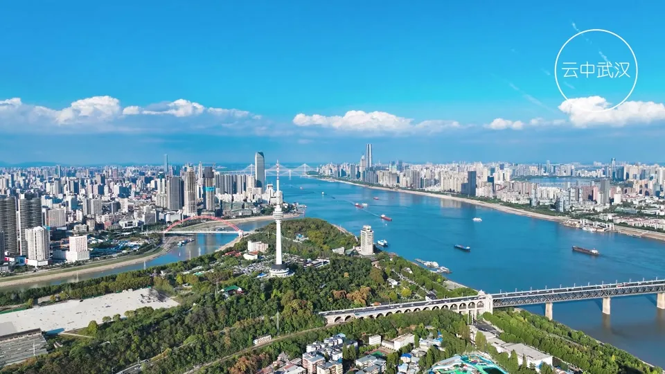
The Wuhan Yangtze River Bridge, completed 1957. The first bridge ever built across the Yangtze, connecting Wuchang and Hanyang.
Wuhan is three cities divided by two rivers. The Yangtze splits Wuchang from Hanyang. The Han River splits Hanyang from Hankou. For most of the city’s 1,800-year history, the only way across was by boat. Ferries ran when the weather allowed. In summer flood season and winter fog, they stopped. Every typhoon, every heavy rain, every mechanical breakdown on the ferry fleet meant the three towns were cut off from each other.
The ferry I wrote about elsewhere, the 1.5-yuan ride that’s still running, is a pleasant tourist experience today. In 1948, it was a lifeline, and it was unreliable.
The Dream
Sun Yat-sen proposed a Yangtze bridge at Wuhan in 1919. Nobody built it. The Nationalist government surveyed the site in 1930. Nobody built it. The Japanese occupied Wuhan from 1938 to 1945. Nobody built it. The Nationalists came back, but still nobody built it.
The problem was engineering. The Yangtze at Wuhan is 1.2 to 1.6 kilometers wide, depending on the season. The riverbed is sand and silt, 30 meters deep in places. The water level fluctuates 15 meters between dry season and flood season. Foundation work had to survive a river that could rise 15 meters and carry debris, logs, entire trees at 3 meters per second. Nobody in China had done this before. Nobody anywhere had done it on a river this wide and this volatile.
In 1953, the new People’s Republic signed an agreement with the Soviet Union: the Soviets would provide engineering expertise, and China would provide labor and steel. Construction began on November 1, 1955.
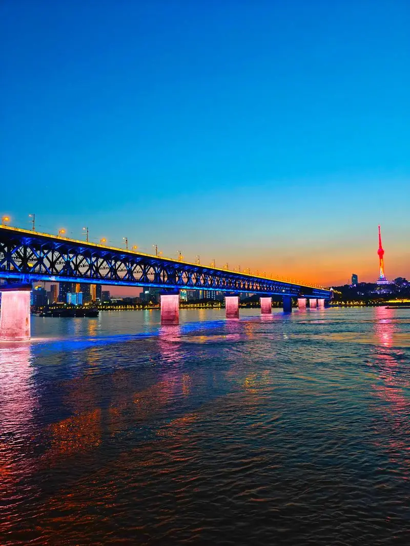
The bridge memorial, recording the construction from 1955 to 1957. Soviet engineering, Chinese labor.
The First Bridge: 1957
The bridge took two years to build. 1,676 meters long. Double-deck steel truss. Trains on the lower level, road traffic on top. Eight pier foundations, each sunk into the riverbed using the “open caisson” method: enormous steel-and-concrete boxes, 40 meters across, pressed into the sand by their own weight while workers inside excavated the riverbed beneath them by hand.
The Soviet chief engineer was Konstantin Silin; the Chinese chief engineer was Wang Juqian. Soviet engineers reviewed the design and Chinese workers built it, with about 30,000 workers on site at peak construction.
The bridge opened on October 15, 1957. It was the first bridge ever built across the Yangtze River, anywhere along its 6,300-kilometer length. Mao Zedong wrote a poem about it: “A bridge will fly across, turning a natural chasm into a thoroughfare.” He also swam across the Yangtze that year, which may or may not have been a metaphor.
The bridge cost 138 million yuan, which in 1957 money was enormous. But the economic return was immediate. Trains from Beijing could finally cross to Guangzhou without being ferried across the river car by car. The Beijing-Guangzhou railway, China’s main north-south rail line, was complete, and Wuhan stopped being three towns and started being one city.
The Sino-Soviet split
In 1960, the Soviet Union withdrew all technical advisors from China. The split was bitter; Soviet engineers went home, and blueprints were packed. Spare parts shipments stopped.
The bridge was three years old. It was designed with Soviet steel specifications and Soviet maintenance protocols, but now the Soviets were gone, and the bridge had to last.
Chinese engineers took over and reverse-engineered the maintenance requirements. They sourced domestic steel for repairs and developed their own inspection procedures. The bridge stayed open. It has been in continuous use since 1957, 69 years as of this writing, and has never had a major structural failure.
My father-in-law drove a truck across it in the 1970s. He said the bridge would shake when two trucks passed each other going opposite directions. The engineers knew about the vibration. They monitored it. They reinforced the deck in the 1980s. The shaking stopped. The bridge held.
38 years of one bridge
From 1957 to 1995, there was exactly one road bridge across the Yangtze at Wuhan. One. For a city that grew from 2 million to 7 million people in that period. Hard to imagine today, but that’s how it was for 38 years.
The congestion was legendary. In the 1980s, trucks could wait six hours to cross during holidays, and the bridge carried everything: freight trains, passenger trains, cars, trucks, buses, bicycles, pedestrians. The ferries kept running because the bridge alone could not handle the demand.
If you lived in Wuchang and worked in Hankou, or vice versa, you planned your life around the crossing. You took the bus early. You avoided peak hours. You knew which ferry times were least crowded. The river was still a wall, and it just had one door in it.
The dam breaks: 1995 and after
The Second Yangtze River Bridge opened in 1995. Cable-stayed design, 1,876 meters, connecting Wuchang to Hankou directly. It was the first new Yangtze crossing in Wuhan in 38 years. It lit up in rainbow colors at night, which the first bridge, in its Soviet industrial seriousness, never did.
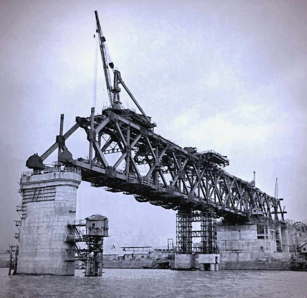
Multiple Yangtze crossings visible from above. Wuhan went from one bridge in 1957 to eleven today.
After that, the pace accelerated. China’s economy was booming, and Wuhan’s geography demanded crossings. Here is the timeline:
| Year | Bridge | Type | Connects |
|---|---|---|---|
| 1957 | First Yangtze Bridge | Steel truss, double-deck | Wuchang ↔ Hanyang |
| 1995 | Second Yangtze Bridge | Cable-stayed | Wuchang ↔ Hankou |
| 2000 | Baishazhou Bridge | Cable-stayed | Wuchang ↔ Hanyang |
| 2001 | Junshan Bridge | Cable-stayed | Outer ring bypass |
| 2007 | Yangluo Bridge | Suspension | Northeast bypass |
| 2009 | Tianxingzhou Bridge | Cable-stayed, road-rail | High-speed rail crossing |
| 2011 | Erqi Yangtze Bridge | Cable-stayed, 616m main span | Wuchang ↔ Hankou |
| 2014 | Parrot Island Bridge | Suspension, bright orange | Wuchang ↔ Hanyang |
That’s eight Yangtze bridges within Wuhan. Add the 400 kilometers of elevated highways connecting them, and the highway network itself, and the three towns are no longer three towns. They’re one city. The mental divide persists. People still identify as Wuchang, Hankou, or Hanyang, but the physical barrier is gone.
The Parrot Island Bridge deserves a mention. It opened in 2014 and is painted bright international orange. From the first bridge, you can see it downstream, a vivid orange line against the gray water. It’s the most photogenic of all Wuhan’s bridges, which is saying something, because the first bridge is handsome in a 1950s-industrial way and the Second Bridge lights up in rainbow at night.
The Han River bridges
The Yangtze gets the attention, but the Han River also needs crossing. The Han is narrower, 200 to 400 meters across, but it still divides Hankou from Hanyang.
The Jianghan Bridge, built in 1956, was the first modern bridge across the Han. It opened one year before the Yangtze bridge, which means for one year, you could drive from Hankou to Hanyang but not from Hanyang to Wuchang. The Yangtze was still the last barrier.
Today there are at least six bridges across the Han River within Wuhan. I say “at least” because I may have lost count. They blend into the infrastructure. Nobody writes poems about the Zhongjiacun Bridge or the Yuehu Bridge. They just drive across them.
What the bridges changed
Before 1957, the river decided your day. Where you lived, where you worked, whom you married, where you could eat lunch. The river shaped all of it. My wife’s grandmother couldn’t attend her aunt’s funeral because the river was rough.
After 2014, you can drive from any point in Wuhan to any other point in under an hour. The river is a detail. You cross it without noticing. On the metro, you’re underground when you cross, and you don’t even see the water.
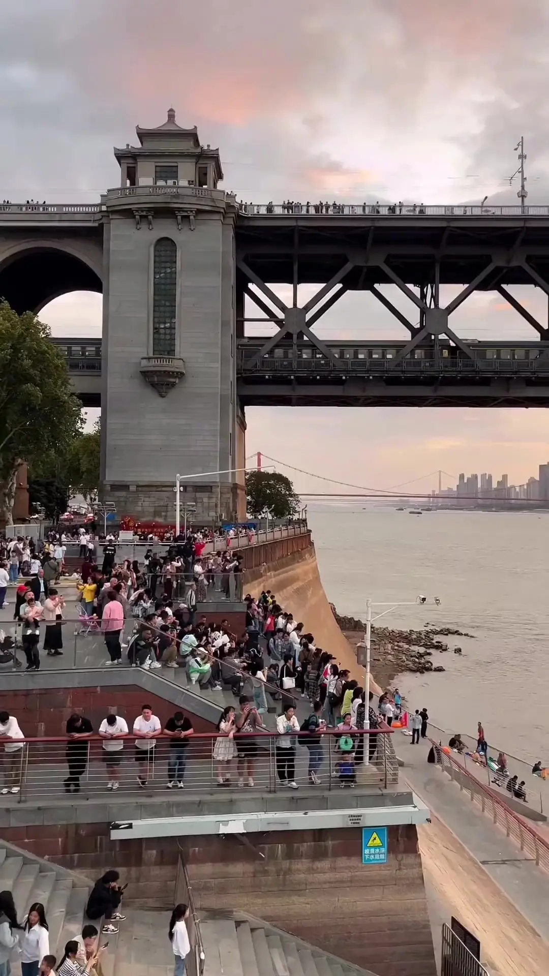
Daily life on the bridge today. Pedestrians, e-bikes, commuters. The bridge that changed the city is now just a road.
I have mixed feelings about this; the bridges are unambiguously good. They saved lives and grew the economy. But something was lost when the river stopped being a barrier: Wuhan used to be three places with three characters. Hankou was fast and commercial, while Wuchang was slow and intellectual. Hanyang was quiet and industrial. Those differences are blurring. You can live in Wuchang and eat in Hankou every night. People do. The towns are merging.
My wife’s grandmother passed away in 2019. She lived to see eleven bridges cross the river that once kept her from her aunt’s funeral. I asked her once what she thought of all the new bridges. She said: “The first one was the one that mattered, and after that, they’re just roads.”
She was right, in a way. The First Bridge was the one that ended isolation. Every bridge after that was an improvement, but none of them changed the fundamental fact. The First Bridge turned three towns into one city, and everything else just made the one city easier to get around.
Seeing the bridges
If you visit Wuhan and want to understand the bridge story:
Walk the First Bridge at sunset. It’s still free, still the best free experience in the city. The pedestrian walkway on the south side gives you the river, the confluence, the cargo ships, and the city skyline from a vantage point no building can match.
Take the ferry from Hankou to Wuchang. It costs 1.5 yuan, takes 20 minutes, and gives you a water-level view of the First Bridge from downstream. You’ll also experience what crossing the river was like before any bridges existed.
Look for the Parrot Island Bridge from the First Bridge’s south walkway. The orange suspension bridge downstream is impossible to miss. It’s a good demonstration of how bridge design evolved in 57 years, from steel truss to suspension, from utilitarian to decorative.
Don’t try to see all eleven bridges. They’re not a tourist attraction. They’re infrastructure. See the First Bridge, see the ferry, and you’ll understand what the bridges meant.
Read more about how the rivers created three towns, about walking the First Bridge at night, and about the ferry that still runs.
Related:
-
Walking the Yangtze Bridge at Night : the First Bridge as a pedestrian experience
-
Two Rivers, Three Towns: Understanding Wuhan’s Geography : why the bridges were needed
-
The Wuhan Ferry: Crossing the Yangtze for 1.5 Yuan : what crossing was like before bridges
-
Wuhan’s Elevated Highways: The Concrete Canopy : how the bridges connect to 400 km of elevated roads
-
Hanyang: The Iron Works That Forged Modern China : the town the First Bridge connects to Wuchang
-
The River Is the City: Wuhan’s Yangtze Culture : the river the bridges cross
-
3 Days in Wuhan: A Local’s Itinerary : the bridge walk is Day 3’s finale
Sources
Bridge dates, dimensions and construction details follow the published records.