
The second city above the first
I learned to drive in Wuhan. Not on quiet suburban roads but on the elevated highways, the ones that run 15 meters above the ground, looping over rivers and lakes and old neighborhoods. My instructor took me up there because the surface streets were too chaotic for a beginner. “Up there,” he said, pointing at the concrete ramp ahead of us, “nobody is reversing a tricycle into your lane.”
He was right. Up on the elevated highways, Wuhan makes sense. The chaos of the street level, the e-bikes, the food carts, the pedestrians who treat crosswalks as suggestions: all of that disappears below you. What’s left is a grid of concrete ribbons, six lanes wide, sweeping across the city in graceful curves. You can see the whole city from up there. The Yangtze glinting in the distance. The East Lake spreading out below, flat and green all the way across. The Bund rooftops in Hankou. It’s the best free view in Wuhan, and you get it while driving 80 kilometers per hour.
Wuhan has over 400 kilometers of elevated highways. That’s not a typo. Four hundred kilometers of road built on concrete pillars, running above the city like a second street system. Some sections are eight lanes wide. Some are three levels stacked: surface road, elevated road, and metro line, all sharing the same corridor. The interchanges are enormous, knots of curving ramps that look like concrete roller coasters from above.
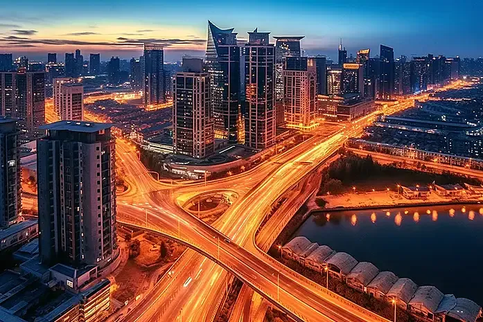
A Wuhan interchange at dusk. 400 kilometers of elevated road, and you’re looking at one knot in the network.
Why Wuhan needed them
The problem is geography. I’ve written about how Wuhan is split into three towns by the Yangtze and Han rivers. For most of the city’s history, those rivers were walls. You crossed them by ferry, or after 1957, by the Yangtze River Bridge. One bridge. For a city of millions. (The full bridge history is here.)
By the 1990s, Wuhan had a few more bridges, but the surface streets on both sides were a mess. Old neighborhoods, narrow roads, markets that spilled into traffic. You could drive from Wuchang to Hankou, but it would take an hour to cross 10 kilometers of gridlocked surface streets before you even reached the bridge.
The elevated highways were the solution. Instead of widening old streets, which would mean demolishing thousands of homes, the city built new roads above the old ones. Pillars went up in the median strips of existing avenues. Concrete spans were hoisted into place. The road on the ground stayed exactly where it was. The road in the sky was something new.
The first major elevated highway, the Wuhan Elevated Inner Ring, opened in 2000. It was 28 kilometers of elevated road forming a loop around the city center, crossing the Yangtze on the Second Wuhan Yangtze Bridge and the Han River on the Jianghan Bridge. For the first time, you could drive from Hankou to Wuchang in 20 minutes. Before the elevated ring, the same trip took over an hour.
The network kept growing. By 2010, the inner ring, middle ring, and outer ring were all under construction simultaneously. New elevated expressways (the Airport Expressway, the Jiefang Avenue Elevated, the Xiongchu Avenue Elevated) pushed outward, connecting suburbs and Optics Valley to the city center.
Today, if you drive from Wuhan Tianhe Airport to my shop on Jiefang Avenue in Hankou, you can do the entire 25-kilometer trip on elevated road without touching a surface street. Thirty minutes, no traffic lights, no pedestrians, no tricycles.
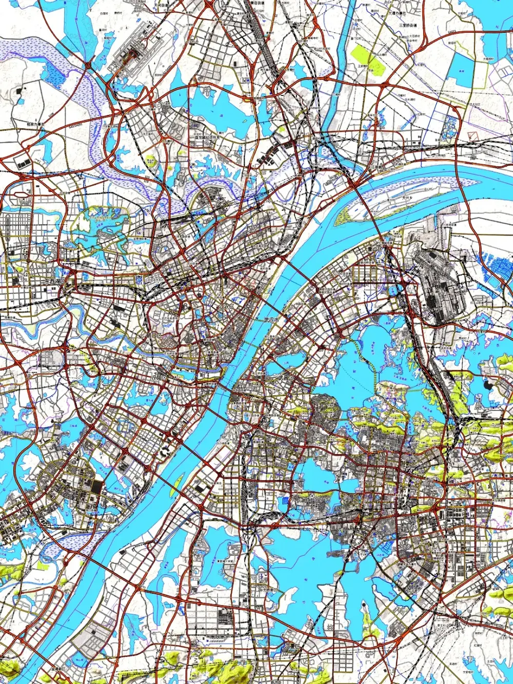
Three rings, dozens of radial spokes. Wuhan’s elevated network is designed to keep the three towns connected.
The engineering
Building an elevated highway is different from building a ground-level road. You’re not just paving; you’re constructing a building that happens to be a road.
Each pillar is a reinforced concrete column, typically 1.2 to 1.5 meters in diameter, sunk into foundations that go 20 to 30 meters underground. The spans between pillars are usually 30 meters: precast concrete segments hoisted up by crane and bolted together. The road surface on top is asphalt, same as any highway, but the structure beneath is a continuous concrete bridge.
The challenge in Wuhan is the water. The city sits on a floodplain with a high water table. When you dig a foundation 30 meters deep in soil that’s saturated with water, the hole wants to fill itself. Foundation construction requires drilling through wet soil, pumping out water, and pouring concrete into holes that are actively trying to collapse. It’s slow, expensive, and requires engineering that would be unnecessary in a city on dry, solid ground.
Then there are the river crossings. Every elevated ring that connects the three towns has to cross at least one major river. The bridges are massive: the Second Wuhan Yangtze Bridge is 4.7 kilometers long. The Yingwuzhou Yangtze Bridge, which carries the middle ring, is a suspension bridge with a main span of 850 meters. These aren’t just road bridges. They’re engineering landmarks that took years to build and cost billions of yuan.
The interchanges are where it gets visually spectacular. When two elevated highways cross, the connection requires a tangle of curved ramps, each one a separate bridge, spiraling up or down to merge traffic from one road into the other. The Wangjiadun Interchange, where the inner ring meets the airport expressway, has five levels of road stacked on top of each other. Driving through it feels like being inside a concrete origami sculpture.
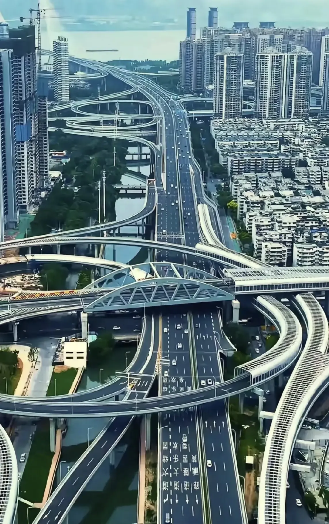
The Wangjiadun Interchange: five levels of road, stacked like concrete origami. Navigating it requires faith in signage.
What it’s like to drive up there
I’ve been driving Wuhan’s elevated highways for over a decade. Here’s what nobody tells you.
First, the noise. Concrete pillars and asphalt surfaces amplify tire noise into a constant low roar. The sound barriers, those blue plastic panels lining the edges, help in residential areas, but on the open stretches, it’s just you and the engine and the hum of tires on rough road.
Second, the wind. Fifteen meters up, with nothing but low barriers between you and the open air, crosswinds hit harder than they do on the ground. In winter, when the north wind comes down the Yangtze valley, the elevated highways can be genuinely sketchy for small cars. I’ve felt my car shift lanes in a gust.
Third, the views. This is the part I love. The elevated highways give you a perspective on Wuhan that you can’t get any other way. Driving south on the Xiongchu Avenue Elevated, you can see the entire Wuhan University campus spread across Luojia Hill, the old buildings with their green tiled roofs peeking through the trees. Driving east on the Jiefang Avenue Elevated through Hankou, you see the old concession buildings from above, European-style rooftops that look like a different city from 15 meters up. And every elevated crossing of the Yangtze gives you a 360-degree panorama of the three towns that stops being routine around the five-hundredth time.
Fourth, the signage. Wuhan’s elevated highway signage is, charitably, an ongoing experiment. Exits are sometimes announced 500 meters before they appear, sometimes 200 meters, and sometimes, on older sections, not at all. The combination of Chinese and English text on the signs is inconsistent. GPS helps, but the elevated layers confuse navigation apps. Your phone thinks you’re on the surface road, and it takes a few seconds to realize you’re 15 meters higher than it expected. First-time drivers get lost. I still get lost, and I’ve lived here for 17 years.
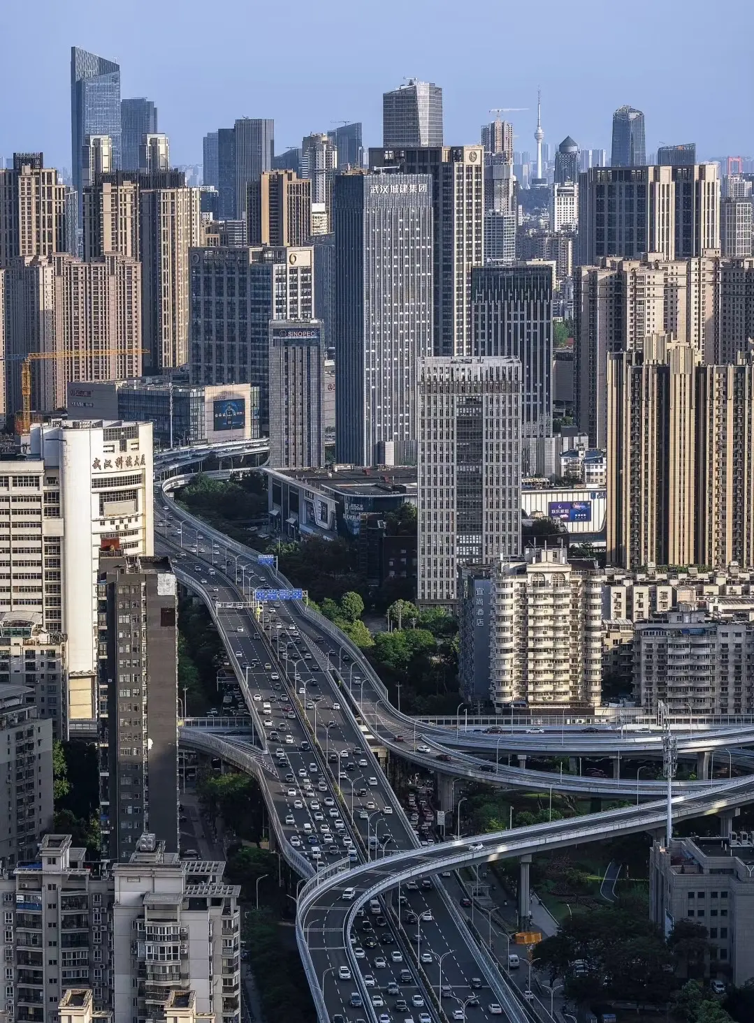
The view from 15 meters up: driving Wuhan’s elevated highways gives you a perspective no walking tour can match.
The cost
All of this came at a price. Not just the financial cost (though that was enormous; the total investment in Wuhan’s elevated network is estimated at over 200 billion yuan) but the human and aesthetic cost.
Building elevated highways means building pillars in existing streets. The pillars go in the median strips, between the lanes, sometimes on the sidewalks. They cast permanent shadows. They block views. They create a ceiling of concrete over the streets below, a canopy that makes some neighborhoods feel like they’re in a tunnel.
The areas directly beneath the elevated highways are the least desirable real estate in the city. The noise from above, the shadow, the concrete pillars blocking storefronts: it’s not pleasant. The city has tried to mitigate this by painting the pillars, adding lighting, and creating pocket parks under the interchanges. But the fundamental problem remains: a 15-meter concrete structure above your street changes the character of the street.
There’s also the question of whether the elevated highways are the right long-term solution. They were built for a city that was growing fast and needed to move cars quickly. But Wuhan is also investing heavily in metro lines. 11 lines operating, more under construction. If public transit absorbs enough demand, some of the elevated highways may become less necessary. Cities around the world are tearing down elevated highways. Seoul removed the Cheonggyecheon elevated highway and turned the space into a river park. Wuhan hasn’t discussed anything like that yet, but the conversation will come.
For now, though, the elevated highways are essential. They’re how 11 million people move across a city divided by two rivers and dotted with 166 lakes. Without them, Wuhan would grind to a halt. With them, you can cross the entire city in 40 minutes. That’s not a luxury. That’s daily life.
| Elevated Highway | Length (km) | Connects | Opened |
|---|---|---|---|
| Inner Ring Elevated | 28 | Hankou ↔ Wuchang ↔ Hanyang | 2000 |
| Middle Ring Elevated | 68 | All three towns, outer loop | 2010 |
| Outer Ring Expressway | 190 | Suburbs and satellite towns | 2007 |
| Jiefang Ave Elevated | 12 | Hankou center ↔ Airport expressway | 2015 |
| Xiongchu Ave Elevated | 10 | Wuchang ↔ Optics Valley | 2016 |
Wuhan’s elevated highways are how the city stays connected. Read more: the full transportation guide, why the three towns need bridges, and the first bridge that started it all.
Related:
-
Wuhan Transportation Guide: metro, ferry, airport, and how to get around
-
Two Rivers, Three Towns: the geography that made the highways necessary
-
Walking the Yangtze Bridge at Night: the 1957 bridge that started it all
-
Wuhan’s Lakes: Why China’s Biggest Lake-City Has More Water Than You Think: the water that makes building roads so hard