
Wuhan is bigger than you think
Wuhan has 11 million people spread across three cities, Hankou, Wuchang, and Hanyang, stitched together by bridges, tunnels, and 12 metro lines. The distance from the airport to downtown is 30 kilometers. The distance from one end of the metro to the other is over 60 kilometers.
If you’re visiting for the first time, transportation is the thing that will either make or break your trip. I’ve watched tourists get off at the wrong station, spend 40 minutes walking in the wrong direction, and end up eating at a random mall instead of the night market they were trying to find.
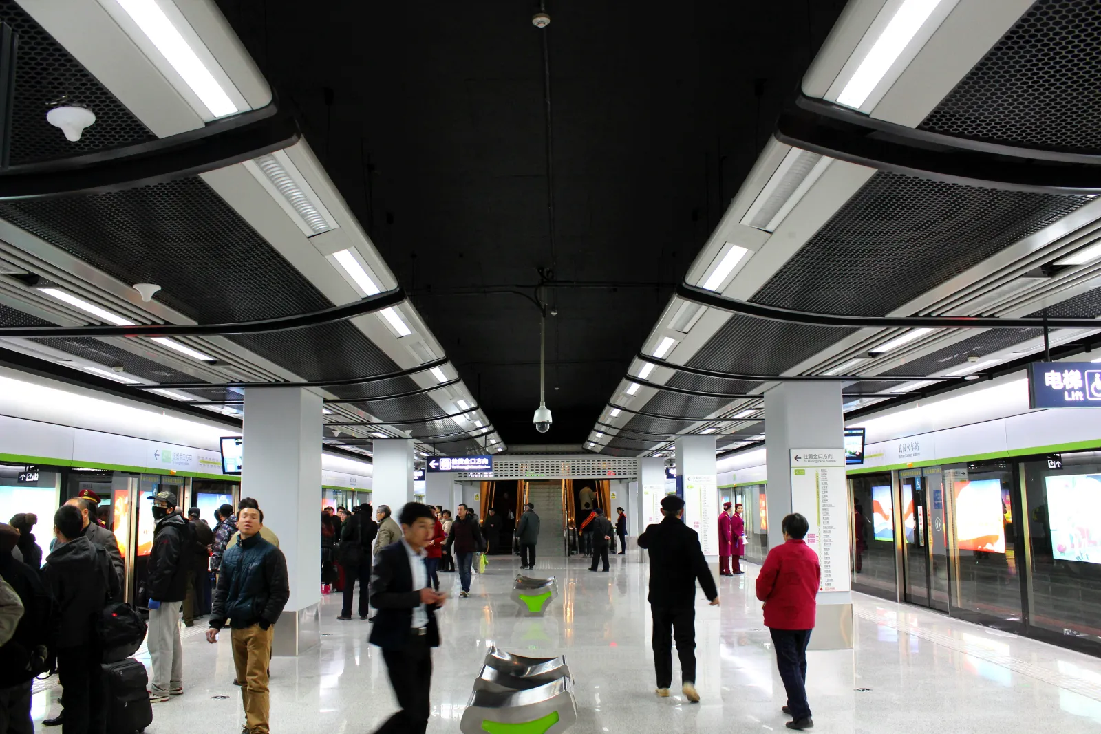
Wuhan’s metro system: 12 lines, 400+ stations, and still growing.
Here’s everything I’ve learned about getting around Wuhan in 18 years of living here.
From the airport
Wuhan Tianhe International Airport (WUH) is 30 kilometers north of the city center. You have three options:
Metro (recommended): Line 2 runs directly from the airport to the city center. It takes about 50 minutes to reach Hankou stations and 70 minutes to reach Wuchang. Trains run every 5-8 minutes from 6:00 am to 11:00 pm. Cost: 7 yuan.
Taxi: 30-40 minutes to Hankou, 50-60 minutes to Wuchang, depending on traffic. Cost: 80-120 yuan. Use the official taxi queue at the airport; ignore anyone who approaches you inside the terminal offering rides.
Airport bus: Runs every 30 minutes to several downtown stops. 40 minutes, 32 yuan. Less flexible than the metro, but more comfortable if you have heavy luggage.
The metro system
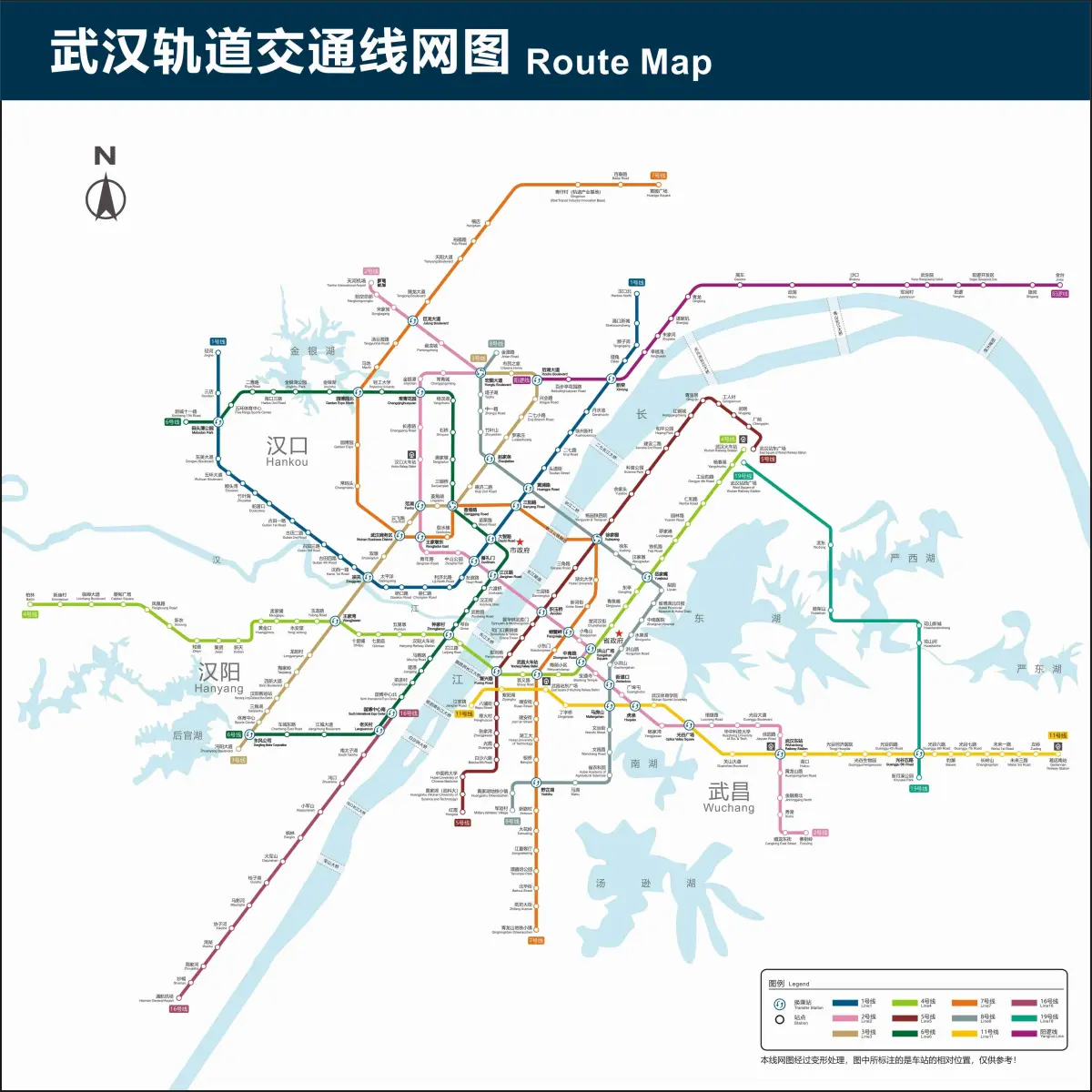
The Wuhan metro network: 12 lines connecting the three towns across the Yangtze and Han rivers.
Wuhan’s metro has 12 lines and is still expanding. For a visitor, you only need to know about four:
Line 2: The backbone. Runs north-south from the airport through Hankou, under the Yangtze, into Wuchang. This is the line you’ll use most. It connects to Wuhan University (Guangbutun Station) and the Hankou Bund (Jianghan Road Station).
Line 4: Runs east-west through Wuchang. Connects Wuhan Railway Station (high-speed rail) to the Yellow Crane Tower area and the Hubei Provincial Museum.
Line 1: an elevated loop around Hankou. Useful for reaching Jiqing Street and some of the older neighborhoods.
Line 8: Crosses the Yangtze via tunnel. Connects East Lake to Hankou.
Operating hours: 6:00 am-11:00 pm (last trains depart around 10:30 from terminal stations). Don’t miss the last train; taxis after midnight are scarce and expensive.
Peak hours: 7:30-9:00 am and 5:30-7:00 pm. Avoid these. The trains are packed to the doors. I once watched a tourist with a backpack try to squeeze into a Line 2 train at 8:15 am. He bounced off the crowd like a pinball and had to wait for the next one.
Payment: Get a Wuhan Metro transit card at any station service window (20 yuan deposit, then load as you go). Or use Alipay: open the app, search “武汉地铁乘车码”, and scan the QR code at the gate. WeChat Pay has the same feature.
Taxis and Ride-Hailing
Taxis are cheap by Western standards: 10 yuan flag-fall (first 2 km), then 2 yuan per kilometer. A typical cross-town ride costs 25-40 yuan.
The problem: Most taxi drivers don’t speak English. Have your destination written in Chinese, or show them the location on a map app.
Ride-hailing: DiDi (滴滴) is the Chinese equivalent of Uber. It works well, prices are reasonable, and you can see the route on your phone so you know if the driver is going the wrong way. The catch: the app is in Chinese. If you can’t read it, have a local help you set it up, or use the English-language version of DiDi inside the Alipay or WeChat mini-program.
The Yangtze ferry
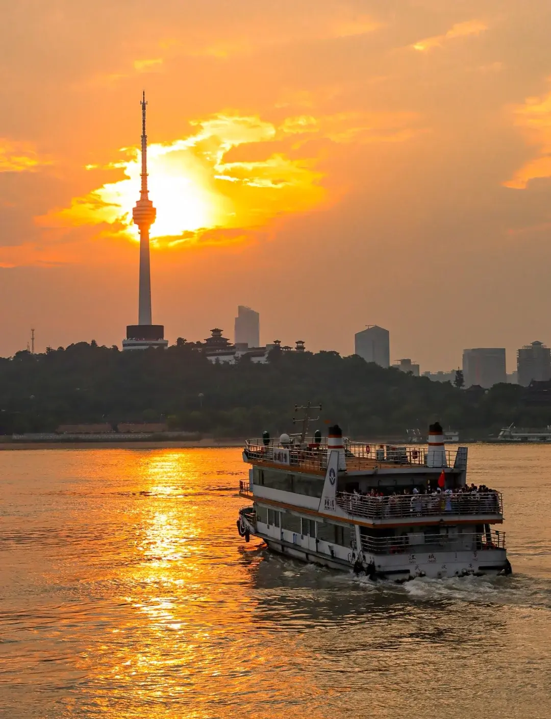
The Yangtze ferry: 1.5 yuan, 10 minutes, the best view of Wuhan’s skyline you’ll ever get.
This is the best 1.5 yuan you’ll spend in Wuhan. The ferry crosses the Yangtze from Hankou (Wuhan Customs House wharf) to Wuchang (Huanghelou wharf) in about 10 minutes. It runs every 20 minutes from 6:00 am to 8:00 pm.
You’ll stand on an open deck with motorcycles, food delivery scooters, and old people carrying groceries. The view of the city from the river is something you can’t get any other way: the Yangtze Bridge from below, the skyline of Hankou behind you, the Yellow Crane Tower on the Wuchang hill above.
Buses (not recommended for tourists)
Wuhan has hundreds of bus routes. They’re cheap (2 yuan) and go everywhere the metro doesn’t. But the signs are in Chinese, the routes are confusing, and the drivers don’t announce stops. If you’re feeling adventurous, bus 401 connects many of the tourist sites in Wuchang. But honestly, just take the metro.
Walking
Wuhan is not a walkable city in the way that Tokyo or Paris is. The blocks are long, the streets are wide, and the summer heat is brutal. But the best parts of the city to walk are:
-
The Hankou Bund promenade: 12 km of riverfront with plane trees
-
The East Lake Greenway: 28 car-free kilometers
-
Jianghan Road pedestrian street: shopping, food, old architecture
-
Around Wuhan University: hills, trees, old buildings
Payment apps you need
For a foreigner, two apps cover nearly everything:
Alipay: download the international version from the app store, then link a card. Use it for metro, DiDi, and most shops. This is the single most important app in China for a visitor.
WeChat: For communication, scanning QR codes at restaurants, and paying at small stalls. Link a foreign card through WeChat Pay.
Cash works at some places, but many vendors, especially small breakfast stalls, only accept WeChat or Alipay. Don’t assume you can pay with cash anywhere.
Practical Info
| Item | Details |
|---|---|
| Airport to downtown | Metro Line 2 (50-70 min, 7 yuan) or taxi (30-60 min, 80-120 yuan) |
| Metro | 6 am-11 pm, 2-7 yuan per ride |
| Taxi | 10 yuan flag-fall + 2 yuan/km |
| Ferry | Hankou ↔ Wuchang, 1.5 yuan, 10 min, every 20 min |
| DiDi | English version inside Alipay/WeChat |
| Payment | Alipay + WeChat Pay (link foreign card) |
| VPN | Download before arrival; Google, WhatsApp, Instagram blocked in China |
Got lost in Wuhan? Better route? Email me. I’ll update this guide.
Related:
-
3 Days in Wuhan: A Local’s Itinerary: how to fit everything into your trip
-
Hankou’s Bund: The European Quarter: best walking area
-
Wuhan Breakfast Culture: Guo Zao: where to eat, how to get there
-
East Lake: Wuhan’s Green Heart: take Metro Line 8
-
Wuhan’s Elevated Highways: The Concrete Canopy Over Three Towns: the second road system above the city
-
Is Wuhan Safe? A Local’s Honest Guide: traffic, scams, medical care, and the real risks
-
Beyond the City: 5 Day Trips from Wuhan: how to get to Mulan Mountain, Liangzi Lake, and Chibi by bus and train
-
Where to Point Your Camera: A Wuhan Photography Location Guide: best photo spots with directions and lens advice
-
What to Buy and Where: A Wuhan Shopping Guide: tea, duck necks, and what to bring home